Product Information
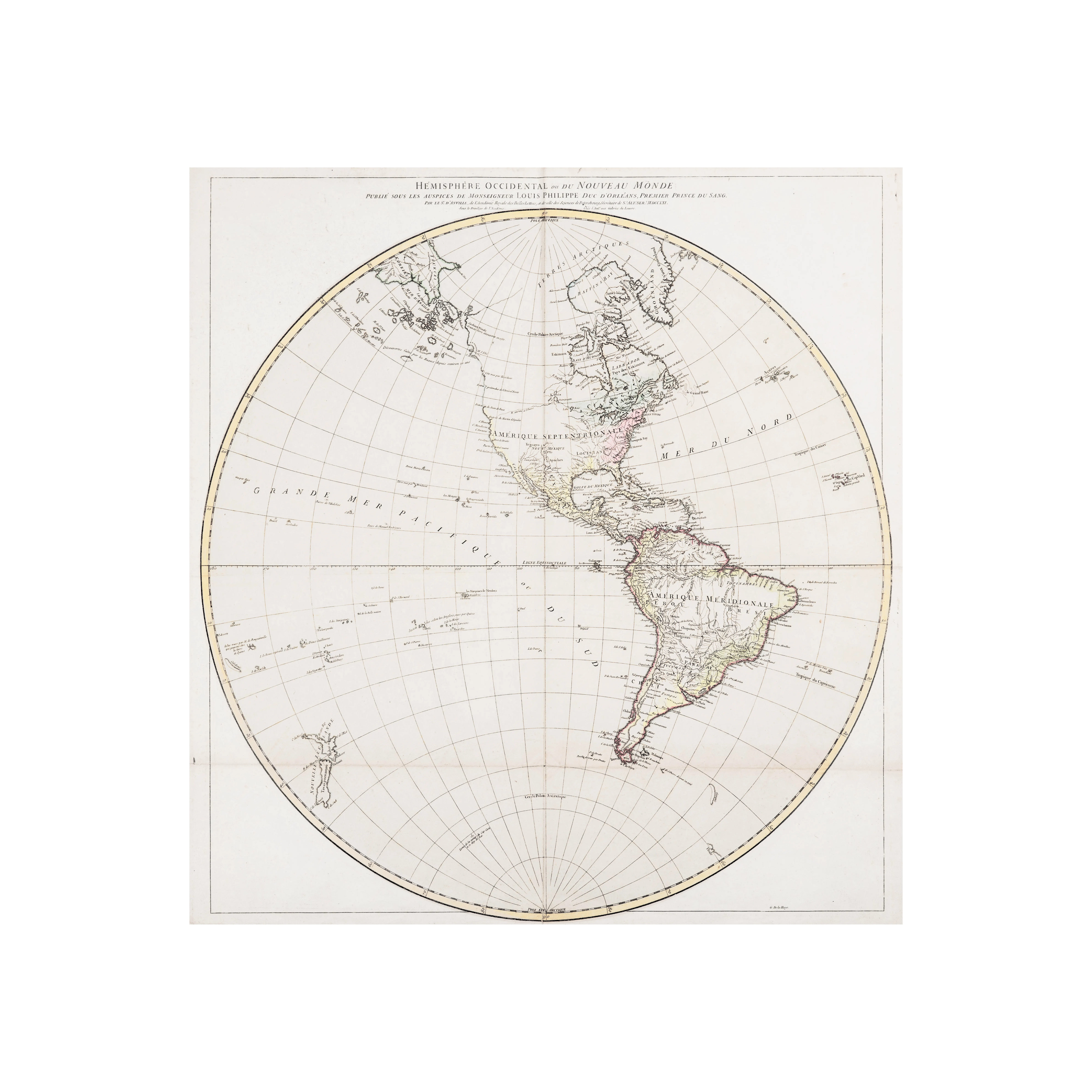
Shop this 1774 old world map for sale. This 18th-century French map by noted map cartographer Jean-Baptiste Bourguignon d’Anville (1697-1782) is a beautiful addition to any interior for someone looking for a continents map or other type of world map wall art.
This finely detailed discourse entitled “Hemishpere Occidental ou Du Nouveau Monde” details the known western hemisphere entitled “Amerique Septentrionale, and includes Nov Mexique, Lousiane, Floride, California, and other areas of America. Much of South America is undefined, as referred to as Amerique Medionale, Bresil, Paraguay, Chile, Guayana, and Perou.
This map was produced according to records in the year 1774. Related to the world’s understanding of cartography and exploration, the initial voyages of James Cook that involved the Royal Navy and Royal Society expedition to the south Pacific Ocean aboard HMS Endeavour took place in 1768 to 1771, so this map presumably was created a few years after this expedition.
This 18th-century version omits a large portation of these known geographies. Jean Baptiste Bourguignon d’Anville was a historically important cartographer. He made significant improvements to the science and art of map-making and geography, which was characterized by his highly detailed work that, up until that point, changes the style, design, and focus of known maps until that time.
Dimensions
This sheet measures 26 x 27.25 inches.
Condition
The paper displays elements of toning, light staining, edge tears on margins, and fold wear. The reverse of the sheet shows linen tape stabilization and darkening near folds.